Powering Emergency Response in a Real-Time Mobile Portal.
Intterra is a leading emergency intelligence platform used by hundreds of public safety agencies to coordinate response, visualize incidents, and communicate with communities during fast-moving emergencies. Serving fire crews, analysts, administrators, and the public, the platform aggregates authoritative geospatial data into a single source of truth.
https://gojilabs.com/wp-content/uploads/2025/12/IntterraGroup_Anim-2025-1.mp4

The Challenge
Intterra’s mission depends on delivering accurate, real-time situational awareness during moments when seconds matter. However, much of their existing platform had been built more than a decade earlier and was struggling to meet modern expectations both technically and operationally. Field responders frequently operated in low-connectivity environments where mobile reliability, offline access, and performance were critical. At the same time, public users increasingly relied on third-party apps for emergency updates, many of which surfaced unverified data and fueled misinformation during active incidents.
Compounding the challenge was the complexity of Intterra’s ecosystem. The platform had to serve multiple audiences with different needs public users, agency administrators, analysts, and field personnel while integrating deeply with authoritative data sources such as ArcGIS. The system also needed to support multi-agency deployments, white-label configurations, and strict security requirements. Any modernization effort had to preserve interoperability, maintain trust with agency partners, and introduce new capabilities without disrupting ongoing emergency operations.
Our Approach
We began with deep discovery across both user experience and system architecture, combining stakeholder research with technical feasibility assessments. While design clarity was important, the primary objective was to build a mobile platform that could reliably ingest, render, and synchronize large volumes of geospatial data in real time often under degraded network conditions. Using insights from our UX Research, we mapped workflows across public users, administrators, and field responders to ensure the system supported real-world emergency behavior rather than idealized use cases.
From a technical standpoint, we architected the platform as a React Native application built for long-term scalability and multi-tenant deployment. The system was designed to support multiple agencies most notably Intterra and Cal Fire through a single codebase with environment-based configuration for branding, API endpoints, and feature flags. This approach allowed Intterra to deploy new agency instances efficiently without duplicating engineering effort, laying the groundwork for future state-level and national expansion.
Technical Architecture & Implementation
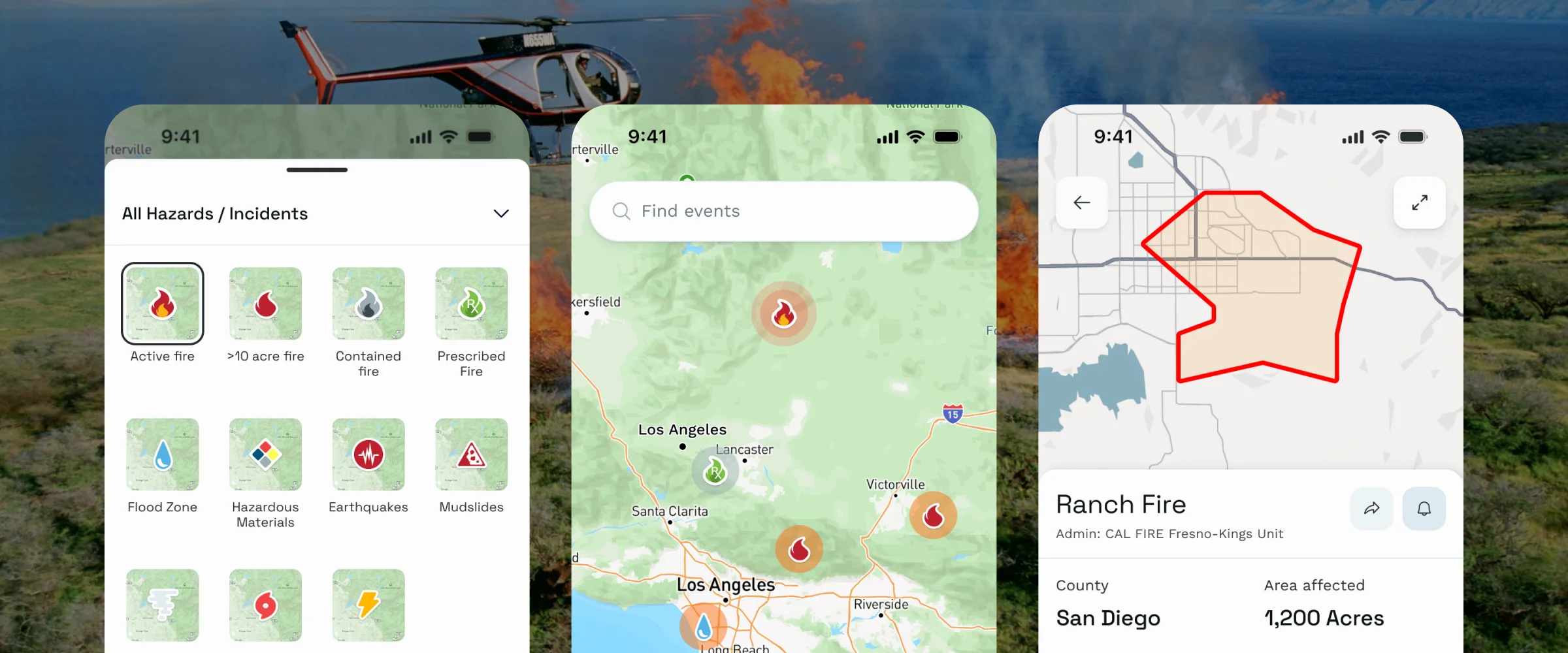
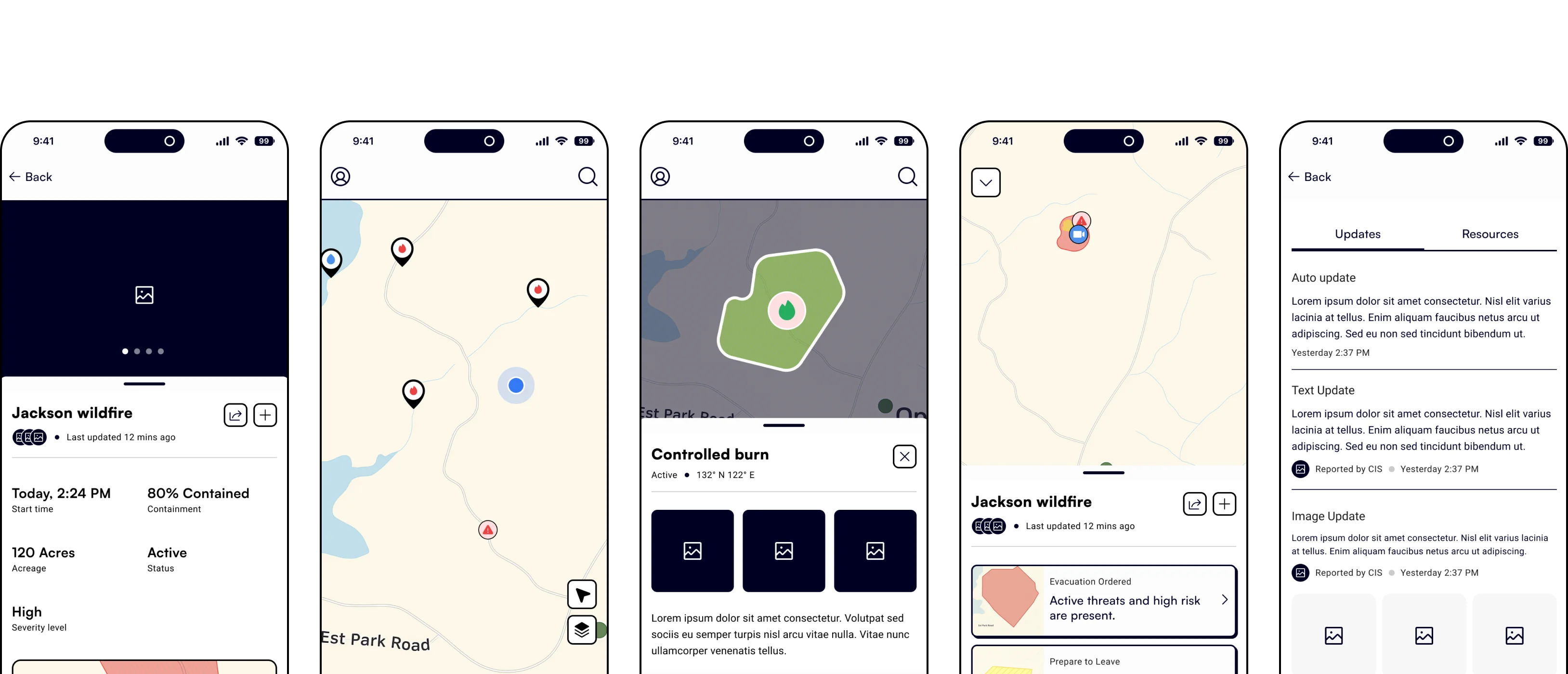
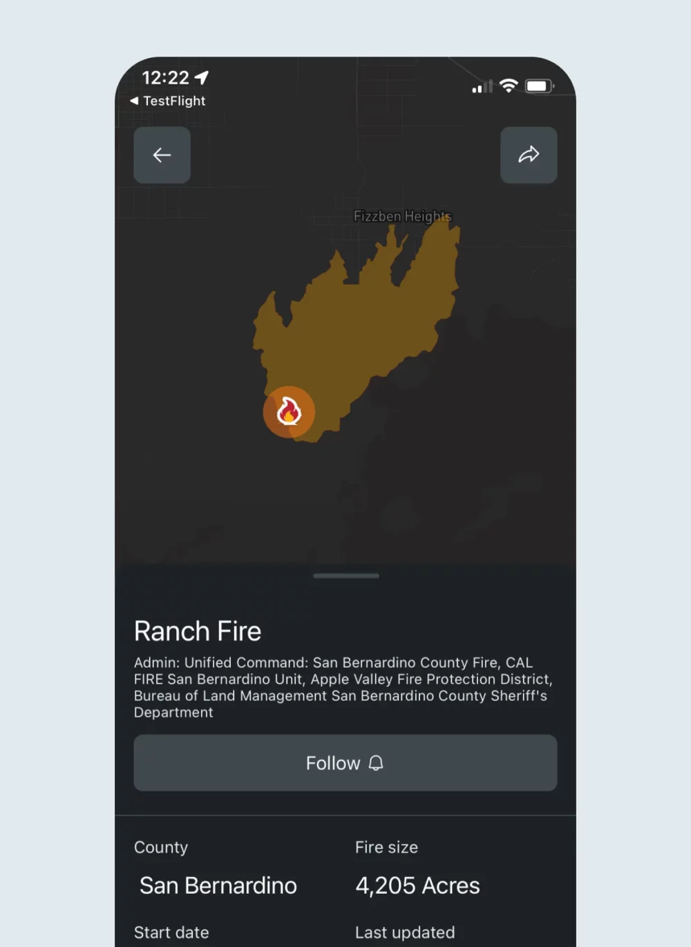
A major technical focus was advanced geospatial visualization using Mapbox. We implemented a dynamic, server-driven layer management system that allowed agencies to control which data layers were visible, how they were ordered, and how they interacted. This included complex scenarios such as aircraft tracking with animated trails, incident clustering, camera orientation rendering, and viewport-based performance optimizations particularly critical on Android devices.
To address performance constraints, we introduced optimizations that limited animations and data updates to what was visible within the user’s viewport, significantly reducing JavaScript thread load. Offline-first strategies were implemented using cached data and background synchronization, ensuring responders could retain situational awareness even in remote or infrastructure-damaged areas. Throughout development, we collaborated closely with Intterra’s backend partners, running structured agile sprints and validating progress through proof-of-concept deployments across multiple agencies.

The Impact
The result was a technically robust, production-ready mobile platform capable of supporting real-time emergency intelligence at scale. The new system replaced a 15-year legacy architecture, significantly reducing technical debt while introducing modern performance, security, and deployment practices. Agencies gained a reliable public-facing portal to communicate verified information directly to communities helping reclaim narrative control during high-pressure incidents and reduce reliance on unofficial third-party tools.
From an operational standpoint, the platform enabled offline usage for field personnel, improved responsiveness under heavy data loads, and introduced a scalable multi-tenant model that supports rapid onboarding of new agencies. The success of the MVP directly contributed to exclusive partnerships most notably with Cal Fire and positioned Intterra as a national leader in emergency intelligence technology. The platform now serves hundreds of agencies with a foundation built for continuous evolution rather than incremental patching.
- Faster and more consistent product decision-making
- Reduced duplication, rework, and operational waste
- Clear ownership and accountability across teams
- Measurable impact on adoption, performance, and ROI
- Scalable framework for future initiatives

Project Review

Rob Wolf
CEO
“Every second counts in emergency response. By modernizing our platforms with Goji Labs, we’re closing the gap between data, decision, and deployment. This collaboration allows us to deliver verified, real-time information to both first responders and the public.”